I need to figure out some plans with a friend and want to get a good idea of how long it will take to get across town at rush hour. Not my favorite time to drive, but if I know my departure time and place, can I have Google Maps show me estimated travel time for later in the day?
I grew up in the era of folding printed maps and the endless puzzle of trying to figure out where you were on the impossible-to-refold-properly sheet of paper. Google Maps is an enormous jump from that crude technology and it stands on the shoulders of a number of earlier mapping systems, notably including Magellan and Magnavox, the latter producing the first GPS receivers. Google Maps actually started out as a separate company too: it was original a standalone program from a company called Where2 Technologies, acquired by Google in 2004. The first web-based Google Maps beta came online in 2005 and we’ve never looked back!
Shortcuts: Where you at? | Where you heading? | When do ya want to leave?
What’s not obvious during all that time is that Google has kept improving the Maps program. The obvious improvements are things like bike routes and public transportation, along with better building and terrain information and rendering, but there’s more. At its heart Google is a data company, so it should be no surprise that it’s been collecting traffic and route data for years! Every time you see a road turn yellow or red due to traffic, that’s not just data being acted upon, it’s data being stored for later analysis too.
The end result is that Google Maps is eerily good at predicting travel times based on historical traffic and route information, even hours, days, or even weeks into the future. It can’t predict a traffic accident, of course, but it can certainly take into account the busiest “rush” hours and how that impacts travel and trip duration. In fact, let’s have a look at how it all works. To do that, I’m going to use the Web-based interface on my computer since it offers a bigger screen. Turns out it’s super easy to transfer directions from the Web to your phone, so it’s a nice way to plan routes too.
WHERE YOU AT?
Most of the time when you go to maps.google.com you’ll find it magically knows where you are, even when you’re on your computer rather than a mobile device. The standard interface looks like this:
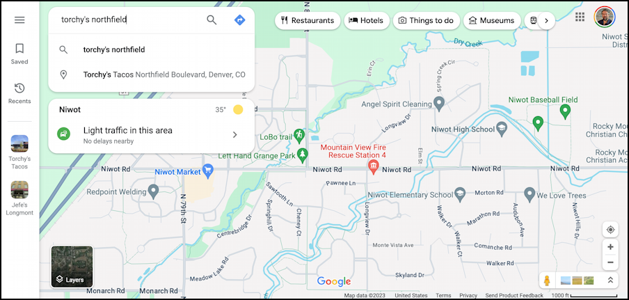
As it happens, I am scheduled to take my son to the Denver International Airport this morning, followed by meeting my pal Steve for lunch at Torchy’s Tacos at the Northfield Shopping Center in Denver. My question is how long will it take for me to get from the airport to Torchy’s at lunchtime?
The first step towards answering this question involves picking the endpoint on the map. To do that all I need is sufficient information for Google to, well, Google the answer. I’ll try “torchy’s northfield”…
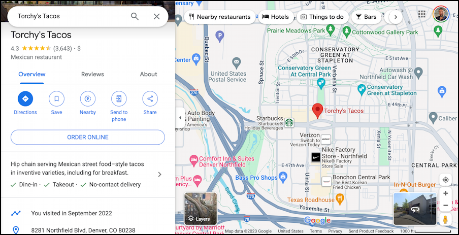
That was sufficient for Google to identify the restaurant which, you’ll notice, is on Northfield Blvd, but in Denver. No worries, it figured out a match. Now, to get directions from the airport.
WHERE YOU COMING FROM?
Notice the blue “Directions” button on the left side. A click and it’ll be ready to deliver driving – or biking, or walking – directions. Once you enter your starting point…
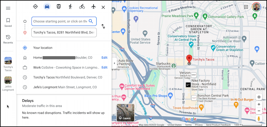
The top box says “Choose starting point or click on the map” but it’s another Google search box, so I can get my originating address by simply typing in a few letters (the FAA 3-letter ID for Denver International Airport is “DEN”):
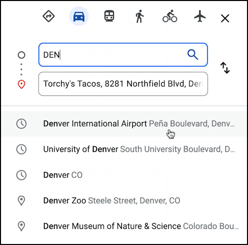
You can see that the very first option is Denver International Airport. Impressive! And just what I want. When I click on it, the map updates with a couple of possible routes:
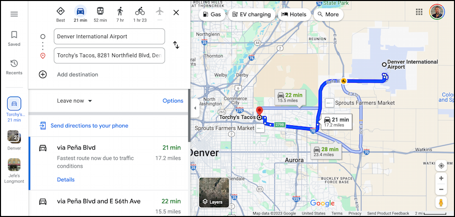
As you can see, there are three reasonable routes with estimated durations of 21 minutes, 22 minutes, and 28 minutes. The shortest, via Peña Blvd, has automatically been chosen and is the one I’d choose anyway. But… I don’t want a route based on the assumption that I’m leaving the origination point immediately. To change the timing of a Google Maps route, you’ll want to find and click on the “Leave now” link (in the middle of the left pane).
WHEN DO YOU WANT TO LEAVE?
Click on “Leave now” and a tiny menu pops up:
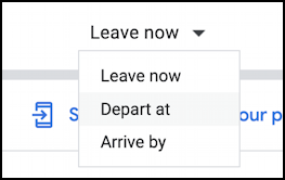
I think I’m most intrigued by the “Arrive by” but I know I’ll be dropping my son off at 11.30am so I’m going to use that time instead. I’ll choose “Depart at“, which brings up a tiny additional window:

Now the magic: Once I close this window, having specified when I want to depart, Maps updates the timing of the routes and shows typical traffic patterns for a few hours into the future:
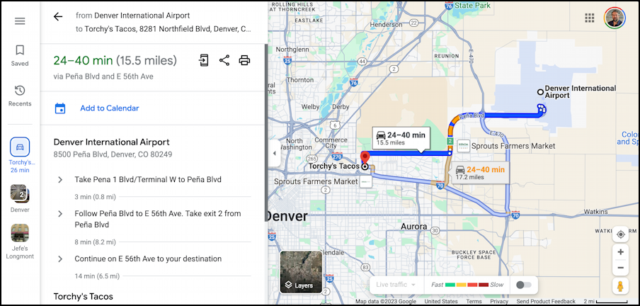
Notice that the times went up and it’s predicting slow-downs along Peña Blvd too, slowing me down a few minutes or possibly more than 15 minutes depending on actual traffic. Pretty amazing, and, of course, it might be startlingly accurate or off by a significant margin if there’s an accident that closes the highway or a herd of bison shuts down the offramp or similar.
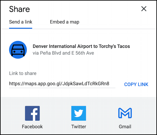
Definitely what I wanted to know, so “approx. 30 minutes” seems like a reasonable estimate of Airport -> Torchy’s time. I can share that, and my route information, with Steve by clicking on the three-dot-with-two-lines share button too. It pops up this tiny window:
Remarkable technology and surprisingly easy to utilize for your route planning. Now to get my son to the airport for his flight…
Pro Tip: I’ve been writing about Google utilities for years and years. While you’re visiting, please consider visiting my Google Help Library for lots of helpful tutorials and how-to articles on almost everything Google. Thanks!
